
I didn’t sleep exceptionally well. One reason was the rocks under my tent. Another was that my bladder was about to explode. But it was cold outside and I was convinced that if I waited long enough, the uncomfortable sensation would eventually go away. I was wrong and eventually went outside. After that I slept remarkably better until I was awoken in the early morning light to the sound of my tent shaking violently. Fortunately it was Ian, not a bear. It was time to get this party started!
 Like any other day, the first priority was making a cup of coffee, which in this case was some special cinnamon Don Francisco, courtesy of my friend Blake. Yum. My method for brewing coffee on the trail is incredibly clunky but it works (barely) and doesn’t taste too much like dirt. We then cooked some freeze dried eggs that I had been looking forward to for weeks….a let down of epic proportions. But it was a hot breakfast in the mountains and the mosquitoes weren’t out yet, so really, what’s there to complain about?

Without the weight of our camping supplies, our packs felt remarkably light and we seemed to be zipping across the landscape towards the incline at the base of the mountain. Of course I was still carrying my large and very heavy camera. Oh well, I have learned that if I want good photos, there is no substitute for that camera. It was about 5 miles to the summit (one way) and we had to cross a number of streams, pass a few lakes, and cross a small basin before starting the steep part of the ascent.
 After passing the last lake, we left the trail and started hiking up and across a meadow of sorts, following a drainage that was cascading melting snow, feeding the numerous lakes below. Then we found this skull. Neither of us being hunters, we really didn’t know what it belonged to but our guess was an Elk perhaps. Hopefully we would fare better in this place than this animal! We were now having to cross more and more patches of snow. At first it was a novelty, seeing snow in August. But eventually the reality set in that hiking across old, crusty snow is really not that much fun.

And here is the final part of the approach leading up to the incline. There is no official trail to the summit, but our route was to aim for the low gap in the saddle, then find the fairly narrow route that can be climbed all the way up the southwest slope to the summit. It’s the only route that does not require technical gear, so it was important that we find the correct route and stay on it. It was certainly not as much snow as our climb up South Sister in Oregon several years ago, but it was enough.
 I was trying to find a route to avoid as much of the snow as possible. Hiking across the wide expanses of snow was exhausting, trying to keep from slipping. And it was giving me a bit of vertigo so I just tried to keep my head down and only look forward. Maybe it was the altitude, maybe it was the steep incline, or maybe it was the repeating pattern on the snow. Maybe it was the thought of slipping and sliding all the way back down to the lake! At least I knew the upper portion of the climb would be free of snow.
The hike was getting steep and I noticed a group of 3 guys up ahead of us. Just below the saddle I heard one of the guys tell his friends that he was done. He said the steep snow field was giving him vertigo and he didn’t think he could go any further. I was secretly feeling the same way but was too stubborn to admit it, even to myself. The thought of returning home and telling stories about not reaching the summit was completely appalling, but I was questioning if we had in fact selected something beyond our skill.
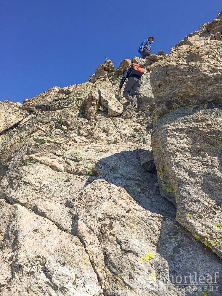
We finally made it to the saddle and met up with what was left of the group ahead of us. We were all a bit perplexed looking at the next stage of the climb. There was no obvious path, just a wall of nearly vertical rocks. Ian and I watched while the two other guys (who seemed much more experienced than us) started climbing, searching, and eventually coming back down. They were convinced that was not the route. Were we really going to make it all this way, only to get stuck at this crux?
After resting, Ian and I decided to give it a shot. The four of us hiked up to the rock wall where a worn foot path abruptly ended and started climbing. Ian lead the way for a bit and found a good way up the rocks. It was extremely steep, but not particularly difficult climbing. At this point I was more concerned about getting back down. After a short distance the slope leveled out to a more manageable 45 degree angle or so.
Up the boulders we went. Up and up and up. It didn’t take long before the thin air started taking it’s toll on me. I was spent beyond all recognition, to the point that I almost didn’t care about the incredible view that was all around me. I was mostly looking down at the rocks, plotting my next move in 10 – 20 feet increments. Because that’s the most I could go without needing to rest.
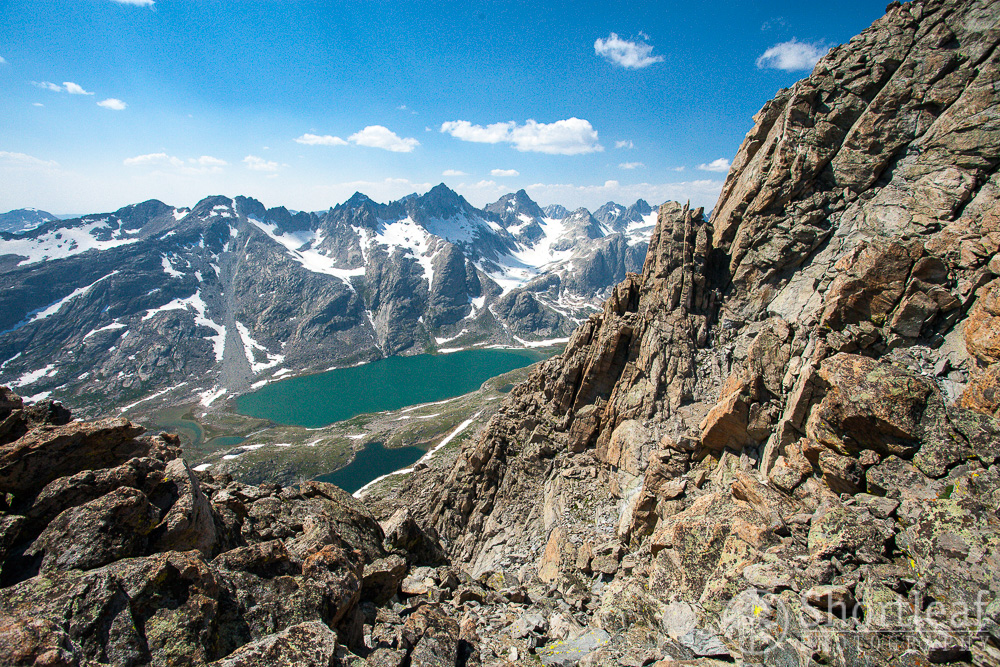
One thing I did notice was a lake up in the mountains on the other side of this lake. It was still completely frozen. According to my map it was called Summer Ice Lake. A fitting name indeed for a body of water that remained a sheet of ice even into August.

When doing a long, physical activity I often get a soundtrack stuck in my head. At first it was “Long Way Down” by the Goo Goo Dolls. But eventually altitude sickness set in and I became so delirious that the only thing I could hear was Dory from the movie Finding Nemo. I pictured the little blue cartoon fish swimming circles around me, obnoxiously saying “Just keep swimming climbing!” over and over and over and over. It was so annoying. I wasn’t sure what I wanted more…. to reach the summit, or to punch Dory in the face.
I was tired and extremely nauseous. The top was close, but I had absolutely nothing left. This entire stretch of the climb accounted for less than 1/2 of a mile, but it took us 3 hours. Ian and I were separated by maybe 100′ of distance and the wind was howling. We had no energy to yell, but we occasionally waved, if for no other reason than to indicate to each other that we were still somewhat alive and pressing on.

All of a sudden I noticed a row of rocks directly above me with blue sky behind them. It had to be the top. I climbed up to the ridge, the continental divide, and slowly (and carefully) made my way over to what appeared to be the high point. The actual high point was a pedestal shaped rock. I thought about climbing on top of it, but the entire summit ridge was terrifically exposed, a giant cliff on the back side, along with a 40 mph wind blowing in the direction of the large glacier field that lay a few thousand feet below.
I felt absolutely miserable so I sat on a rock and waited a few minutes as Ian made his way across the narrow ledge to the summit. We had both made it to the top so we hi-5’d and sat down for lunch. Normally, this is my favorite part of the trip. Enjoying lunch on top of the world. But today I was too sick to eat anything, though I tried to choke down some crackers, hoping maybe it would make me feel better. It did not.
 A photo of success, and the face of a guy desperately trying to resist the urge to vomit. Ian on the other hand was basking in the glory of success!
I hoped that if I rested for awhile, my nausea would improve but it didn’t, so eventually I reluctantly stood up and started back down. The steep stretch above the saddle that had taken 3 hours to climb only took about 30 minutes to descend. And miraculously I suddenly felt better as we reached the top of the snow field. We sat and talked to 3 guys from Idaho for awhile and eventually decided to carry on.
All of that snow that we slowly climbed earlier in the morning now looked like a suitable slide. So we sat down and went for it, making it a considerable distance towards the bottom and expending almost no energy in the process. Our pants were soaked and our boots were full of snow but it was so worth it!

As we descended the mountain and started a fairly casual stroll through the basin I was feeling emotionally overwhelmed. The pain and fatigue of the upward climb was in the past. My altitude sickness was all but gone and we were riding high with the feeling of a successful summit. As we wandered through a valley so incredibly beautiful that I felt unworthy to even see it, I just simply could not contain myself. We stood there looking around, alone in this incredible place. THIS…this is why we came here, I told him.
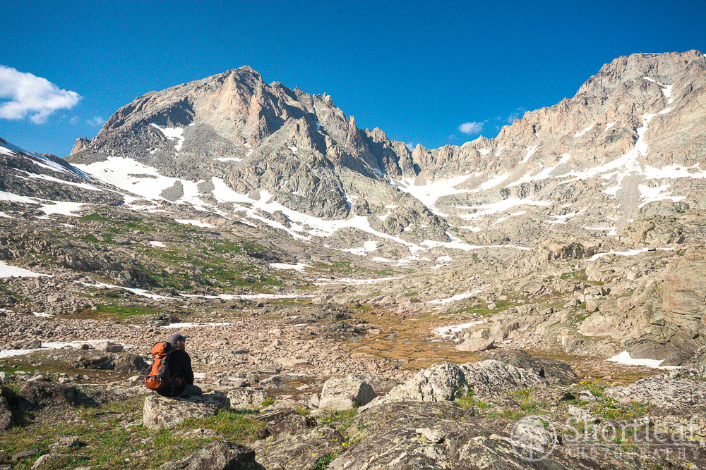
Once we were off the snow slope, the hiking was pretty easy. But we were still tired, and not particularly in a hurry to leave this place. So we stopped a lot and soaked in the scene.
 We weren’t following a trail, just wandering past the lakes, over the boulders and ridges, generally heading in the direction of our camp. The sun was getting low and I was starving, but it was difficult to force myself to speed through this spectacular landscape. Realistically I may never see this place again so I wanted to enjoy it as much as possible.

At long last we reached the shores of our lake. This side of the lake had a really pretty sand beach. It was good to be back near camp, except for the fact that the mosquitoes were still there, and apparently as hungry as I was.

I immediately started making dinner when we arrived back at camp. It was a simple bowl of ramen but it was a hot meal and at the time it seemed like the most delicious dish I’d ever eaten. It was kind of like the scene from the movie “What About Bob”, where Bob is eating the corn.

Being the cheapskate that I am, I thought it would be a good idea to save a few dollars and take a plastic fork. Until it broke. And not only did it break, but it broke in favor of right handed use, so the only way I could get stuff from the bottom of the cup was to eat with my right hand. Sigh. Such is the persecuted life of a leftie.
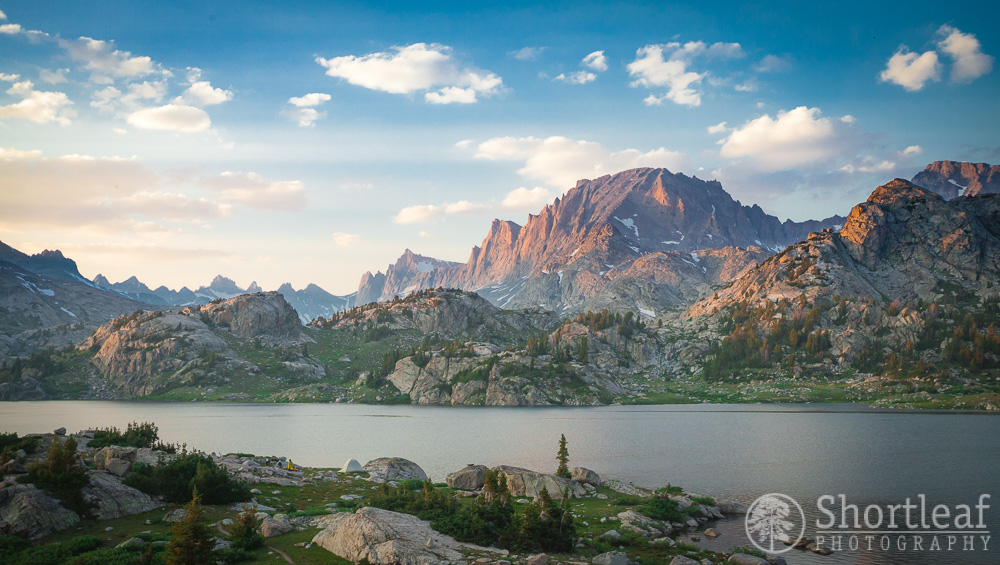
The mountain that looked impossible turned out to be difficult, but not impossible. It took us 12 1/2 hours to reach the summit and get back to camp, but we did it. We then sat and watched the last of the days light glowing on the mountain while sipping on whiskey and swatting at mosquitoes.
The next morning we got up, had coffee and breakfast, then loaded our packs back up and hiked the 12 miles back to the car. We stopped for a late lunch at the Wind River Brewing Company, a rather nice place in a tiny town that seemed like an outpost in one of the most sparsely populated regions of the lower 48. We could barely walk, so we sat in the restaurant for a few hours, ate a lot, and then made our way back to Salt Lake City for our flight home the next morning!


I like how chipper Ian looks in the summit photo. He looks like he’s had a nice leisurely stroll.